blah blah blah
Mt. Parker
Length: 7.8 miles out-and-backDifficulty (click for info): Hard
Elevation Gain: 2580 feet (+250 feet on return)
Rating (click for info): 8/10
Elevation: 3012'
Prominence: 195'
Driving Directions:
Trailhead and parking area are on Cobb Farm Road in Bartlett, NH. To get there, turn north on River Street from Rt. 302 in the center of Bartlett, 6.1 miles west of the northern junction with Rt. 16. Drive 0.5 miles, cross the Saco River, and arrive at a T-junction. Turn left on Cobb Farm Road and then immediately right into the small parking area, marked with a hiking sign. Click here for a Google map.
About the Hike:
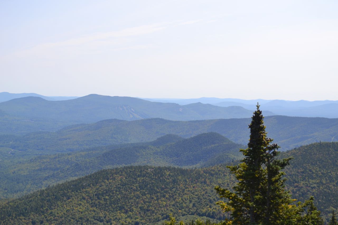
Three major ridges run south from Mt. Washington. The Southern Presidentials, running to the southwest, have the most famous summits, including four of NH's 4000-footers. The Rocky Branch Ridge borders the Rocky Branch of the Saco River on the east side, and is a mostly wooded ridge with no notable summits. The Montalban Ridge borders the Rocky Branch on the west side and is shaped with some of the most rugged and remote terrain of all three. The ridge rises to the summits of Mts. Isolation and Davis as it descends from Mt. Washington's Boott Spur, and further down, the notable peaks of Stairs Mountain and Mt. Resolution, both honored on the 52-With-a-View list. As the Bemis Ridge splits off toward Mt. Crawford, the sharp summit which can be seen driving south on Rt. 302 through Crawford Notch, the main ridge crest of Montalban Ridge begins to swing to the southeast, heading toward its end at the confluence of the main branch of the Saco River with the Rocky Branch. On the way, it passes through a rather remote little area, in the middle of which is the summit of Mt. Parker, poking up just above 3000 feet. Lacking the tremendous rugged qualities of nearby summits Stairs, Resolution, and Crawford, Mt. Parker has only a light brushing of open ledge around its highest point. Most of the mountain is forested over, and the journey there consists of a long approach through hardwood forest, followed by a wild and interesting climb up the crest of the Montalban Ridge. The limited amount of open area on the summit is enough to provide you with a sweeping view over the Rocky Branch valley, a perspective unlike any other.
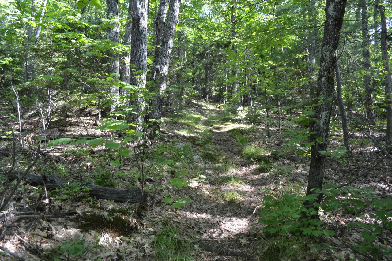
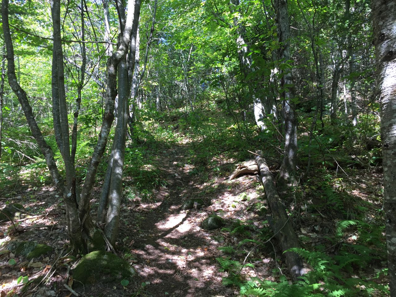
The hike to Mt. Parker begins at the side of the Saco River, on the Mt. Langdon Trail, following an overgrown logging road through an area of recent logging. Reach a junction not far from the trailhead and continue straight as two other logging roads split off to either side of the main road. You will be on this logging road for almost a mile, and the ascent is gentle for the whole way. In 0.3 miles from the trailhead, a small sign on the left points the way to Cave Mountain. Over the next half mile, stay straight on the main logging road as some other, more overgrown paths diverge in various directions. Look for the noticeable herd path through the low brush, as well as blazes and arrow signs which guide your route. An important intersection occurs 0.8 miles from the start. Make sure to bear right on a lower road as another old road forks to the left toward the north summit of Cave Mountain. Just 0.1 miles beyond this junction, the trail leaves the old road and heads into the woods on the left side. In another tenth of a mile, you will pass the boundary marker for the Presidential Range-Dry River Wilderness. Just beyond the sign, the trail crosses a brook and begins to ascend in the valley beside it. It remains close by the brook for the next quarter mile, then crosses back to the other side and reaches a flat area to the north of Cave Mountain. It levels off for 0.1 miles, then takes a right turn and begins climbing up a moderate slope. It bends back across the slope to the left, but after 0.2 miles, swings back uphill to the right. The trail then begins a 0.6-mile ascent up a broad ridge leading to a peak on the crest of the Montalban unofficially named "Oak Ridge". Mostly moderate grades are found here, but some sections have loose footing. A few open, grassy areas in the forest are passed higher up in the climb. The trail crosses the summit of Oak Ridge, then makes a 0.3-mile, 225-foot descent into the col separating Oak Ridge from Mt. Parker, where there is a trail junction. At this point, turn left onto Mt. Parker Trail. The trail bears directly up the crest of the ridge, climbing up a section where it makes many short zig-zag switchbacks. In 0.4 miles from the junction, the trail crosses a short, flat area over forested ledges. The trail graudually resumes its ascent, and angles uphill to the right through pleasant open forest for the next 0.35 miles. It then makes a brief, rolling descent into darker spruce woods over 0.05 miles before turning sharply left and back uphill. The trail regains the crest of the ridge in 0.1 miles and heads straight up. The trail ascends moderately, passing an open grassy area and hopping up to the summit in another 0.35 miles.
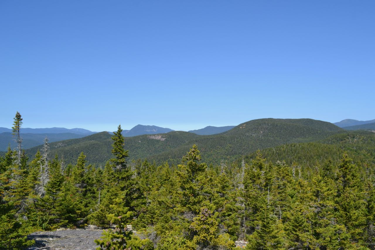
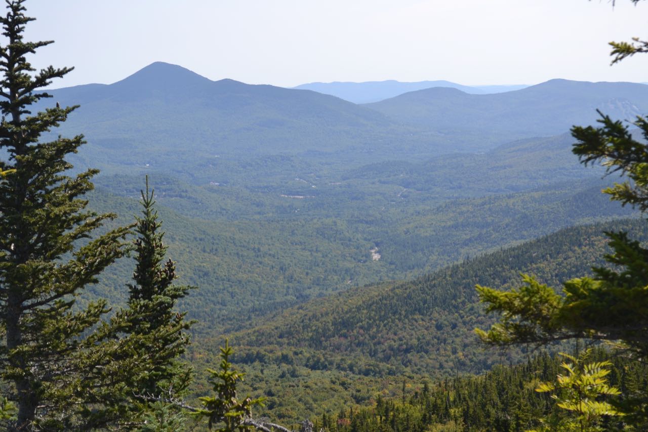
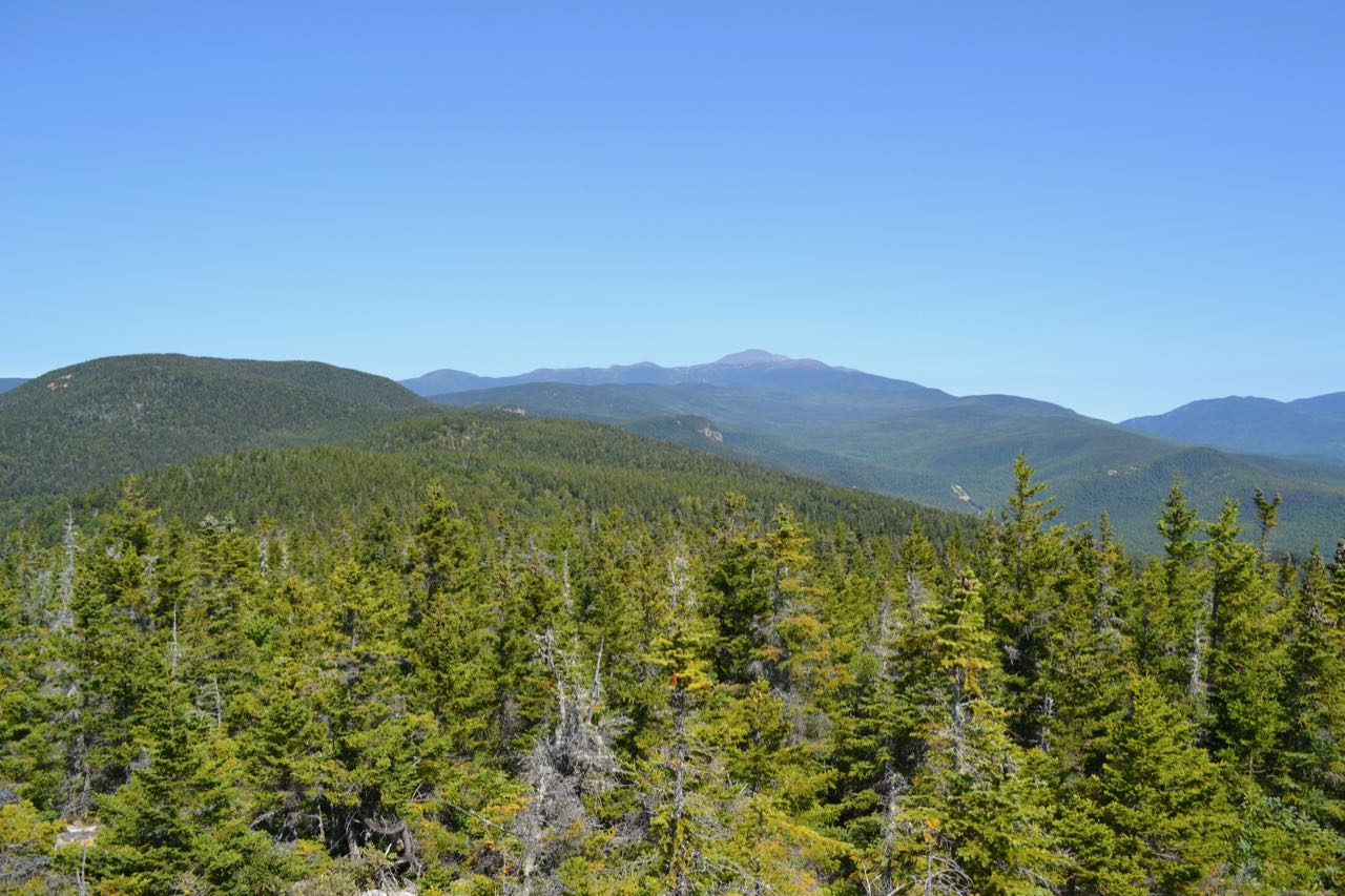
As you walk up to the high point, you are immediately greeted with Mt. Parker's fabulous view of the Rocky Branch valley. An open, bouldery area in the river is noticeable in one spot below Mt. Washington. You can get a sense of the topography as you look further up the Montalban Ridge and across the valley to the Rocky Branch Ridge and view the contrast between the higher Montalban Ridge, with its many cliffs and ledges, and the lower, rolling Rocky Branch Ridge. Closest up, view the oblong mass of Mt. Resolution, the next peak up the ridge from where you are now. Behind it, see the profile of the Southern Presidentials, with all the major peaks visible, save for Mt. Pierce, which is hidden behind Resolution. Further over to the left, the Willey Range and its vast talus slope is seen between the sharp knob of Mt. Crawford and its companion, Crawford Dome. Occupying the left extreme of the view is the distant Twin Range. To the right of Mt. Washington and its ridges is the Carter Range, with Wildcat Mountain and Carter Dome prominently displayed. Trees begin to obstruct the view further over to the east, but Mt. Parker has one of those wonderful summits where exploration leads to the discovery of more scenery. Take a walk through the low bushes to the right over to the east side of the summit, where better views can be seen of the Conway area. The most notable feature over here is the conical Kearsarge North, with the Green Hills at its side to the right. Pleasant Mountain rests in Maine in the background. Below the Green Hills, a ridge at the end of the Moat Range curves around, and a bit closer, you see the end of the Montalban Ridge stretch down over the minor summits of Mts. Pickering and Stanton. In the valley below, you can view another scenic open area in the Rocky Branch, not far from where it joins the main fork of the Saco River. Inspect it closer with binoculars!
Printable directions page